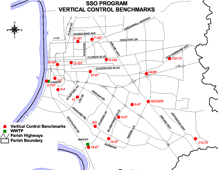
Introduction
In an effort to provide consistent vertical control for use on the SSO Program, the East Baton Rouge Parish Department of Public Works in conjunction with the U.S. Army Corps of Engineers, New Orleans District has established current orthometric elevations on twenty (20) existing vertical control monuments. The datum used for the orthometric elevation survey was NAVD88 using the Geoidal Model 2003. The elevations were determined utilizing dual frequency GPS technology in conjunction with a first order digital level using invar rods. This enabled an accuracy of plus or minus 2 to 3 centimeters relative to the project reference monument which was USGS Monument "E 197" (PID#BJ1001), Elevation = 28.68 feet, NAVD88.
Instructions for use: click on the ![]() next to the benchmark name to view the descriptions.
next to the benchmark name to view the descriptions.